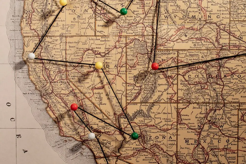
Calculating Latitude and Longitude Midpoint
To calculate the midpoint of latitude and longitude, you can find the center of gravity for a set of locations. This is done by:
- Converting the latitude and longitude of each location into Cartesian coordinates (\(x,y,z\))
- Multiplying the Cartesian coordinates by a weighting factor
- Adding the weighted coordinates together
- Drawing a line from the center of the earth to the new coordinates
- Finding the point where the line intersects the surface of the earth
- Converting the surface point back into latitude and longitude
You can also calculate the average latitude and longitude of a set of points. This method is a close approximation to the geographic midpoint when the distance between the points is less than 250 miles (400 km).
Explanation
- The geographic midpoint is the center of gravity for a set of locations.
- The weighting factor can be based on time spent in each location, population, or other factors.
- The Cartesian coordinates are \(x=\cos (\text{lat})\cdot \cos (\text{lon})\), \(y=\cos (\text{lat})\cdot \sin (\text{lon})\), and \(z=\sin (\text{lat})\).
You can use a Geographic Midpoint Calculator to calculate the midpoint of latitude and longitude.
Example
Understanding Latitude and Longitude Midpoint Calculation
Calculating the midpoint between two geographic coordinates (latitude and longitude) is essential for determining the central point between two locations. This midpoint is useful in various applications such as navigation, route planning, and geospatial analysis.
The key concepts of latitude and longitude midpoint calculation include:
- Latitude and Longitude: The geographic coordinates that define a point's position on the Earth's surface, with latitude representing the north-south position and longitude representing the east-west position.
- Midpoint: The point equidistant from two given locations. This can be calculated by averaging the latitudes and longitudes of the two points.
- Calculating the midpoint is important in navigation, travel planning, and determining the central location between two places.
Steps to Calculate Latitude and Longitude Midpoint
To calculate the midpoint between two geographic coordinates, follow these steps:
- Convert the latitude and longitude of both points from degrees to radians.
- Apply the formulas to calculate the midpoint's latitude and longitude:
Latitude Midpoint = (Latitude1 + Latitude2) / 2Longitude Midpoint = (Longitude1 + Longitude2) / 2- Convert the result back from radians to degrees.
Example: If the coordinates of two points are (Point A: 40°N, 75°W) and (Point B: 42°N, 74°W), the midpoint can be calculated by averaging the latitudes and longitudes of both points.
Methods for Calculating Latitude and Longitude Midpoint
Common methods for calculating the midpoint between two locations include:
- Simple Averaging: This method averages the latitude and longitude of the two points directly to find the midpoint.
- Great Circle Distance Method: This more advanced method takes the curvature of the Earth into account for higher accuracy, especially over long distances.
- Online Tools and Software: Various online calculators and software applications provide tools for automatically calculating geographic midpoints based on input coordinates.
Factors Affecting Latitude and Longitude Midpoint Calculation
Several factors can influence the accuracy of midpoint calculations:
- Geographic Distance: The larger the distance between two points, the more important it becomes to account for the Earth's curvature in the calculation.
- Projection Method: Different map projections may result in slight variations in the midpoint, especially when the coordinates span large areas.
- Measurement Units: Ensure that the coordinates are in the correct units (degrees, minutes, seconds, or radians) for accurate calculations.
Example: When calculating the midpoint between two cities, it's important to use the correct geographic projection method to ensure accuracy over large distances, such as between New York and Los Angeles.
Applications of Latitude and Longitude Midpoint Calculation
Latitude and longitude midpoint calculation is used in various fields:
- Navigation: Determining the central point for planning routes, such as the halfway point on a road trip or flight.
- Geospatial Analysis: Analyzing geographic data to find central locations for research, development, or land use.
- Travel Planning: Helping travelers find central locations to meet or split the difference between two destinations.
- Emergency Response: Identifying the midpoint between two emergency sites for coordination of resources and response efforts.
Example: A delivery company uses midpoint calculations to plan more efficient routes by finding the center of two locations to optimize logistics.
Common Operations in Latitude and Longitude Midpoint Calculation
When calculating the midpoint of two locations, the following operations are commonly involved:
- Converting coordinates from degrees to radians and back to degrees.
- Using averaging or advanced formulas based on the Earth's curvature.
- Ensuring accurate measurements of longitude and latitude for precise midpoint determination.
| Calculation Method | Description | Steps to Calculate | Example |
|---|---|---|---|
| Simple Averaging | Calculating the midpoint by directly averaging the latitude and longitude of two points. |
|
For points (40°N, 75°W) and (42°N, 74°W), the midpoint is approximately (41°N, 74.5°W). |
| Great Circle Distance Method | Using spherical geometry to calculate the midpoint over large distances, accounting for the Earth's curvature. |
|
For long distances between New York and Los Angeles, the midpoint is calculated using spherical geometry to account for the curvature of the Earth. |
| Using Online Tools | Using GPS-based tools or online calculators to determine the midpoint by inputting the coordinates. |
|
Using an online tool, the midpoint between Paris (48.8566°N, 2.3522°E) and London (51.5074°N, 0.1278°W) is approximately (50.2°N, 1.1°E). |
| Using Mapping Software | Calculating the midpoint through mapping software like GIS by plotting the two coordinates and finding the central point. |
|
In mapping software, the midpoint of two points in Africa (Cape Town and Nairobi) is calculated and shown as the central point on the map. |